TerraInsight.com > About
Terra > Technology > STePÛ
>
Paleo-reconstruction
Paleo-reconstruction Analysis![]()
|
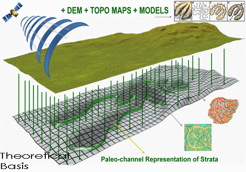
Paleo-Reconstruction or Relief-Plasticity Determines the locations
of hydrocarbon generation, such as depocenters, and pathways of migration on
local, regional and global levels. Via its algorithms, the method converts static
two-dimensional elevation data (topographic, DEM, satellite) of palegeographic
levels or isoline maps into a paleo-channel model. Represented in the model are
respective strata levels showing the geomediums character and trend of movement.
By revealing inferred oil-saturation in channels/systems, paleo-reconstruction reliably
identifies oil-bearing structures and other geological features, such as impact
depressions and paleo deltas, indicative of hydrocarbon prospectivity. In early
exploration phases, these channel maps are especially helpful in determining
hydrocarbon migration direction(s), locating accumulation zones, determining
the genetic dependency between offset production and the area of interest, and increasing
the efficiency of the overall work program. |
|